West Vale - Visiting Our Sites & Local Information
Our publicly accessible sites are all in the Shrivenham area, with the exception of Uffington Gorse wood.
Shrivenham is located in Oxfordshire near the A420 major road between Swindon (approx 6 miles) and Oxford (approx 20 miles). Shrivenham has a by-pass, so careful you may miss it in your rush to get here!
If travelling from Swindon direction take the Bourton turning on the right about a quarter mile after the dual arch railway bridge. (Hackern or Acorn Bridge). You pass over the culverted canal that runs alongside the A420 here. This is the site of Costers Lift Bridge and Bourton Wharf.
Follow the road around to the left, then straight on along Townsend Road which runs into High Street Shrivenham.
If travelling from the Oxford direction. After the Faringdon By-Pass (about 3 miles) on reaching a roundabout take the second exit (signed Shrivenham, Defence Academy) into Watchfield and at the next roundabout (about 100 yards) go straight on and follow this road towards Shrivenham. (Note: pass Watchfield High Street on the right). After about a half mile turn right at a small roundabout into Shrivenham High Street.
There is parking in the High Street but, if just visiting the canal sites, it is probably more convenient to park at the Canal Park, from which all the sites listed below may easily be reached by the towpath.
By Bus: Shrivenham is on Route S6 (Swindon to Oxford), alight at the stop near the Barrington Arms.
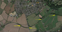
Aerial map showing our sites.
The Canal Park
Is located in Stainswick Lane Shrivenham about 750 yards south of the High Street.
Stainswick Lane joins the High Street just by the Zebra Crossing and the One Stop Shop.
The Canal Park is on the left 200 yards past the Cemetery, there is a small car park.
LOCATION: Nearest Postcode to the Park is SN6 8DW (Glebe Close, 300 yards from the park) and the exact Map Ref is SU24307 88250
Details on the creation of the Park may be found in the Projects section & - here.
Shrivenham Arch Bridge (Station Road Bridge)
The only original bridge on the entire canal still in daily use is located on the B4000 (signed to Lambourn) about half a mile south from Townsend Road/ High Street. It is a Grade II listed building. There is a small place to park on the road next to the bridge adjacent to what remains of Shrivenham Wharf (private property). You can also park in the forecourt to the electricity sub-station 30 yards past the bridge but don't block the gate!
It is possible to walk along the towpath from here westwards to Steppingstone Lane Bridge.
LOCATION: Nearest Post code is SN6 8JL and the exact Map Ref is SU23753 87938
Steppingstone Lane Bridge
Steppingstone Lane runs from the cross roads in Bourton village centre down to the Bridge. It's a green lane and the original ‘road' between Shrivenham and Bourton, now just a bridleway and is a pleasant half mile walk but can be muddy in the winter! Park your car at the beginning of the lane but please don't block gateways.
LOCATION: Nearest Post code Bourton crossroad is SN6 8HZ and the exact Map Ref for the bridge is SU23456 88003
The story of the reconstruction of the bridge may be found in the Projects section & - here.
Tuckmill Brook
The canal crossed this brook on a brick aqueduct, long since demolished. However, the footings may still be seen in the banks, a large spill-weir was also on this site. Access is only by walking eastwards along the towpath from the Canal Park. Currently the towpath ends at the brook and there is no public access to the adjacent land, so visitors have to return back along the towpath.
Uffington Gorse Wood
This recently aquired 9 acre wood lies 850m north-east of Uffington village and includes 200m of unrestored canal. Uffington is about 5 miles east of Shrivenham. The wood is open to the public and there is limited parking at the entrances. See the project page for further information.
USEFUL INFORMATION ON SHRIVENHAM
Doctors Surgery - (hope you don't need this one) In the High Street by the Bus Stop and Stocks.
Chemist - in the High Street.
Shrivenham Memorial Hall - Located at the junction of Townsend Road, High Street and Highworth Road. The hammerbeam roof is well worth a look if the hall is open.
Post Office - In Shrivenham High Street by the zebra crossing.
Places to eat and get takeaway food and drink.
In alphabetical order :
Barrington Arms Hotel - www.thebarringtonarmshotel.com- High Street (has accommodation).
Bloomfields - www.bloomfieldsfinefood.co.uk- Take away food and deli. Also has a courtyard with seating to eat in - High Street.
College Farm - www.collegefarmpub.co.uk/- By A420/Defence Academy roundabout in Watchfield. A Marston's pub.
Coop Foodstores - sandwiches etc. High Street Shrivenham and close to A420/Defence Academy roundabout in Watchfield.
MacDonald's. - Close to A420/Defence Academy roundabout in Watchfield.
Prince of Wales Pub - www.princeofwalesshrivenham.co.uk/- High Street.
Subway - Take away. Close to A420/Defence Academy roundabout in Watchfield.
There are also an Indian restaurant and a Chinese takeaway both in Shrivenham High Street.


